
One of the primary pleasures of recreational vehicle travel is finding new places. That, of course, requires traveling new-to-you roads.
- How can you safely navigate your RV?
- How can you know what’s beyond the next bend in the road?
- How can you get from here to there?
Let’s take a closer look at RV navigation basics to address these questions.
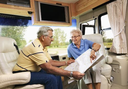
Maps are graphic representations of the location and relationship of places and their connectors. Road maps emphasize the connectors and the roads. (A collection of road maps is called a road atlas.) The size and scale of road maps help drivers select the best (shortest, fastest) path between locations.
In addition to typical map features (city and town names, road numbers, and relative size), RV drivers often require more information for safe travel. Is there a steep grade, low bridge, weight-restricted routes, or sufficient fuel stations?
Large motorhomes and travel trailers often use a Motor Carrier Road Atlas designed for commercial truck drivers. Smaller RVs can use an automotive Road Atlas.
In choosing one, consider the areas you plan to travel to, who will be reading the maps and when (driver before the trip or navigator during the trip), and what scale you need (standard, large).
Many RV road atlases combine directories such as campgrounds and travel services. Other directories tell you what services (fuel, food, camping, etc.) are located at major road intersections.
RV GPS Units

- Large 8″ RV navigator with high-resolution touch display and options for portrait and landscape mode.Control…
- Custom routing considers the size and weight of your RV then finds the best route (not available in all areas)
- Provides road warnings to keep you aware of steep grades, sharp curves, weight limits and more
- Preloaded directory of RV parks and services, TripAdvisor traveler ratings, content from Ultimate Public Campgrounds, KOA ,…
- Control with your voice, and enjoy hands-free calling (requires smartphone, enabled with BLUETOOTH technology) and built-in Wi-Fi…
Technology has dramatically improved RV navigation. The Global Positioning System (GPS) offers pinpoint accuracy to any location in the U.S., Canada, Mexico, and the world within a few feet. GPS uses a constellation of 24 satellites in medium orbit about 12,550 miles (20,200 kilometers) above the Earth.
For example, the east-west latitude of the US Capital Building, Washington, DC, USA, is 38.889931, and the north-south longitude is -77.009003. If you know the exact coordinates of a location, GPS mapping equipment can show you how to get there.
This can be especially helpful for finding new boondock camping sites. The GPS coordinates of Death Valley are 36° 31′ 56.154″ and 116° 55′ 57.147″.
Want to Connect With a Community of Over 1,078 RV Enthusiasts?
Popular GPS mapping equipment for travelers includes products by Garmin, TomTom, Magellan, and Rand McNally. Models change annually, but GPS equipment manufacturers offer free or low-cost updates, some in real-time, to provide the latest traffic conditions.
Most models offer turn-by-turn instructions, often provided by a computer voice. The vehicle’s GPS equipment runs off the rig’s 12V battery.
Smartphones and tablet computers can also be equipped with GPS travel software to guide you to RV destinations. Applications (apps) include MapQuest, Google Maps, Apple Maps, BackCountry Navigator, Polaris, and others.
Many have free versions with upgrade subscriptions. Travel guides are available that offer GPS coordinates for free and low-cost boondock campsites.
Getting lost is more difficult than it used to be, but still possible. Make sure you know how to use the tools of RV navigation for a safe trip.
")


"Man cannot discover new oceans unless he has the courage to lose sight of the shore."
-- Andre Gide


")
